General Information
Location
The topography of Jung-gu resembles a compact version of Busan. The city has outstanding features, with rising mountain peaks and an expansive ocean before it. The peak of Bosusan Mountain juts majestically into the sky. Its ridges are linked to the peak of Gubongsan Mountain in the north. Jung-gu looks over an expanse of blue water from the Busan Port to the south face Although Yongdusan Mountain is now considered an independent hill right in the bosom of Jung-gu, it was originally linked to the peaks of the Bokbyeongsan Mountain ridge to the north.
Longitude-latitude positions
| Extreme Point | Jurisdiction Name | Longitude and Latitude | Extension |
|---|---|---|---|
| Far East | 15 Jungang-dong 4ga | 129° 2’ 40” | East-West 1.8Km |
| Far West | 80 Bosu-dong 3ga | 129° 1’ 15” | |
| Far South | 35 Nampo-dong 1ga | 35° 5’ 30” | South-North 1.7Km |
| Far North | San 1 Yeoongju-dong | 35° 6’ 40” |
Local Characteristics
Performing Urban Functions of Busan
- Business Functions : Concentration of finance, commerce, information, communication, and trading
- Central Shopping Area: Center of commercial district, swarming with visiting & living population
- Busan Port Gateway Function International & Coastal Passenger Line, Port No. 1 & 2
- Center of Culture and Tourism: Yongdusan Mountain, Gwangbok Street, BIFF Square, 40 Steps Theme Street, Busan Modern History Museum
Basic Information ▶ 2019. 12
- Population : 44,051 (Male: 21,880, Female: 21,171), Daily Transient Population: 60 million
- Gross Area: 2.83㎢ (0.37% of Busan) / Climate : Annual average 15.7℃
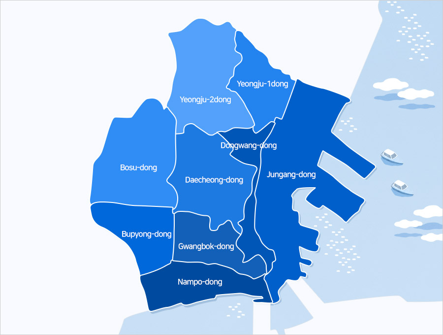
- Administrative Districts 9 administrative districts/dongs (Jungang-dong, Dongkwang-dong, Daecheong-dong, Bosu-dong, Bupyeong-dong, Gwangbok-dong, Nampo-dong, Yeongju 1-dong, Yeongju 2-dong)
- Administrative organization : 3 Bureaus, 1 Department, 15 Divisions, 1 Facility Management Center, 1 Public Health Center, 9 Dongs, 1 Council Secretariat department